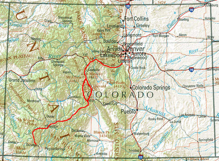
Colorado Trail (CT)

The Colorado Trail is an established, marked, and mostly non-motorized trail open to hikers, horse riders, and bicyclists. From the eastern terminus at Waterton Canyon, southwest of Denver, the trail winds its way for almost 500 miles (800 km) through the state's most mountainous regions, to its final conclusion, about 3.5 miles (5.6 km) north of Durango. Along the way, it passes through eight mountain ranges, six National Forests, and six wilderness areas.
Trail elevations range from a low of about 5,500 feet (1,700 m) at the Denver end of the trail to a high of 13,271 feet (4,045 m) on the slopes of Coney in the San Juan Mountains. The average elevation is over 10,000 feet while the trail rises and falls dramatically. A hiker traversing the entire length of the trail will gain (and lose) about 89,000 vertical feet. The trail passes through what is considered to be some of the state's most beautiful country. Wildlife abounds and wildflowers, in season, are abundant. While much of the trail passes through forests, a good portion of it reaches above timberline, where trees are unable to grow and views are breathtaking.
The trail passes through historic mining towns, along ancient Indian trails, and through a modern, world-class ski resort. Other sections appear much as they would have 500 years ago. The western half of The Colorado Trail, between Monarch Pass and Durango, has less human influence, greater vistas and a display of spectacular wildflowers.
For 235 miles (378 km), The Colorado Trail runs concurrent with the Continental Divide Trail along the Collegiate East route. On the Collegiate West route, the Colorado Trail follows the Continental Divide Trail for 80 miles (130 km) more.
Overview map of CT
I have hiked this trail in South-North directions starting in Durango in 2016.
Like during my thruhike of the PCT and CDT I didn't carry any paper maps. Instead everything was loaded on my smart phone. To have a screen as large as possible combined with a good camera I bought the Experia arc S from Sony. This gave me the following options within one piece of equipment:
-
- Free of charge PDF maps from Ley
- Software BackCountry Navigator with detailed trail from Bear Creek (the maps were downloaded before starting as not to require an internet connection)
- GPS
- Town description from Yogi for all CDT hiker towns as PDF
- Camera
- Radio
- MP3-Player
- Skype via WIFI
- and then of course a telephone
This not only allowed me to save a lot of weight but I could use the build in GPS to determine my exact position with BackCountry Navigator something I had hardly to do.
I recharged the cell phone whenever I could. Additionally I carried the small . This gave me enough power to always be able to use the phone. To avoid roaming fees I bought a prepaid SIM card with US phone number from AT&T. There are only very few pay phones left.
© 2016 by Hamburger
Last updated on
30.12.2025
![]()