E1 Sweden Varberg - Granvik

IIc.9 Section Borås - Ulricehamn 35 km
Borås
Solvik
Ulricehamn 35 km
It rained all night long. And I had to start in the rain in the morning. After some looking around I found the Sjuhäradsleden which is the E1 from here on out. The boots had dried out over night but were soon soaking wet again. From lunch on it became drier and the sun was shining in the evening. Today's path was well marked but really extremely wet. Near Raska-Minas Stuga was a shelter that was not marked on the map. This was a welcome place for lunch. And not so long after lunch I had to quit the path. The inlet for Lake Tolken near Solvik was absolutely impassable. Whatever I tried did not work short of walking through the creek with unknown depth. Even the nearby paved road was closed and impassable. This made a long diversion with plenty of road walking necessary. The first short stretch to Tvärred I was lucky and got a ride. But thereafter no one wanted to stop. On and on I went on the pavement towards Ulricehamn and hoping for the best. Just short of reaching the town finally someone stopped and then took me straight to the youth hostel.
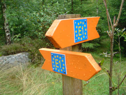
The new markings of European Long Distance Paths were found several times on Sjuhäradsleden
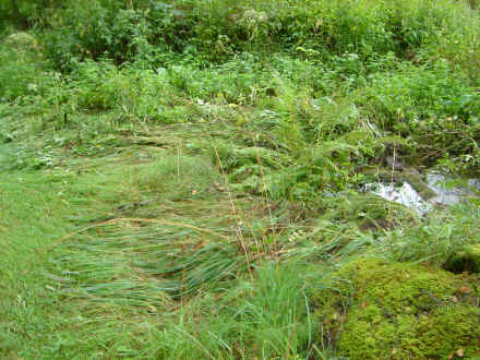
This picture gives an impression of how much it rained last night.
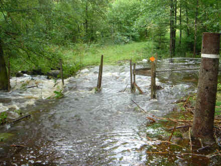
The E1 was impassable near the inlet of Lake Tolken. This should have been an easy furt across the brook.
© 2016 by Hamburger
Last updated on
09.12.2022
![]()