Norge på langs

33 Section Jonstølen - Stranddalen Turisthytte 23 km
Jonstølen
Stranddalen Turisthytte 23.0 km
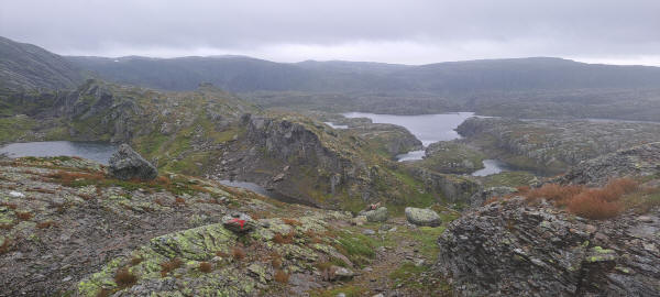
This turned out to be a long hiking day. I started early from the hut down to River Jonstølåno which is crossed on a new bridge. It was dry in the morning. The trail rises steadily until arriving in Valley Kyrkjesteindalen. Here in the valley the rain set in. Then I arrived at the snow fields leading up to Pass Kyrkjesteinskaret. I had been warned of the snow fields by hikers at DNT Jonstølen. They had arrived coming down from the pass. Going uphill it turned out not to be that dangerous and I managed reaching the top. The way down was ok until arriving at Lake Kaldevatn. Now it became a constant up and down. It was very rocky with many steep parts. At one point I was lucky that a group of hiker came approaching me from the other side. I had to get down a vertical cliff face with very little handhelds. I really was not sure how to get down. They helped me after I had thrown my pack down with telling me where the next hand or foothold was. Without their help whis would have been a rather dangerous part.
Before arriving at the point where the trail splits into one leading to Stranddalen and one to Krossvatn I had lunch. I got some cover from the rain below an overhanging rock. I selected the trail to Stranddalen as the following day would be much easier evenso it would be longer today. It continued to be rocky and took me through another up and down part with many small lakes and ponds. The following part along the slope of Mountain Ravnanuten took its time. Finally at past 8pm I arrived at Stranddale Turisthytta. I was expected as another hiker had announced my coming. I got out of my wet clothing and went for dinner which was buffet stile. The other hiker and I where the last people eating. It was very tasty and being ayce I really filled up. Then a quick shower and I went to bed.
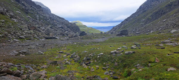
View back in Valley Kyrkjesteindalen
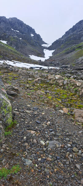
Hiking uphill to Pass Kyrkjesteinskaret
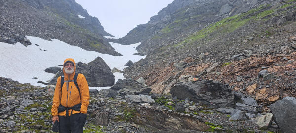
The final hike up to the pass Kyrkjesteinskaret is across dangerous snow fields
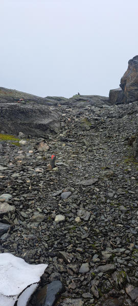
Almost at the top of the pass Kyrkjesteinskaret
Down and up across the rocks always following the red trail markings
<< Bleskestadmoen << >> Storsteinen >>
© 2022 by Hamburger
Last updated on
03.03.2023
![]()